Agronomists Don't Use Drones
From what I’ve seen in Saskatchewan, this is generally true. Agronomists scouting large areas tend not to use drones in their day-to-day scouting, except for maybe late the season just to get a quick aerial view of their field.
Most drone missions take hours to fly and are way too slow for the quick field visit that the agronomist has time for. The reason they take so long is because they rely on mapping with the typical lawnmower approach to collect with side-overlap, usually above 70%.
The nice thing about the lawnmower approach is that each point on the ground is seen from multiple positions, so the scale/GSD of the photos can be solved. This allows quantitative metrics like plants/ft² to be extracted.
Faster Flights using Single Photos
Compared to collecting many photos with overlap, predicting scale for any single photo is like perceiving depth with one eye covered. If we want to extract quantitative data from individual photos, we have to use a different method of establishing accurate scale.
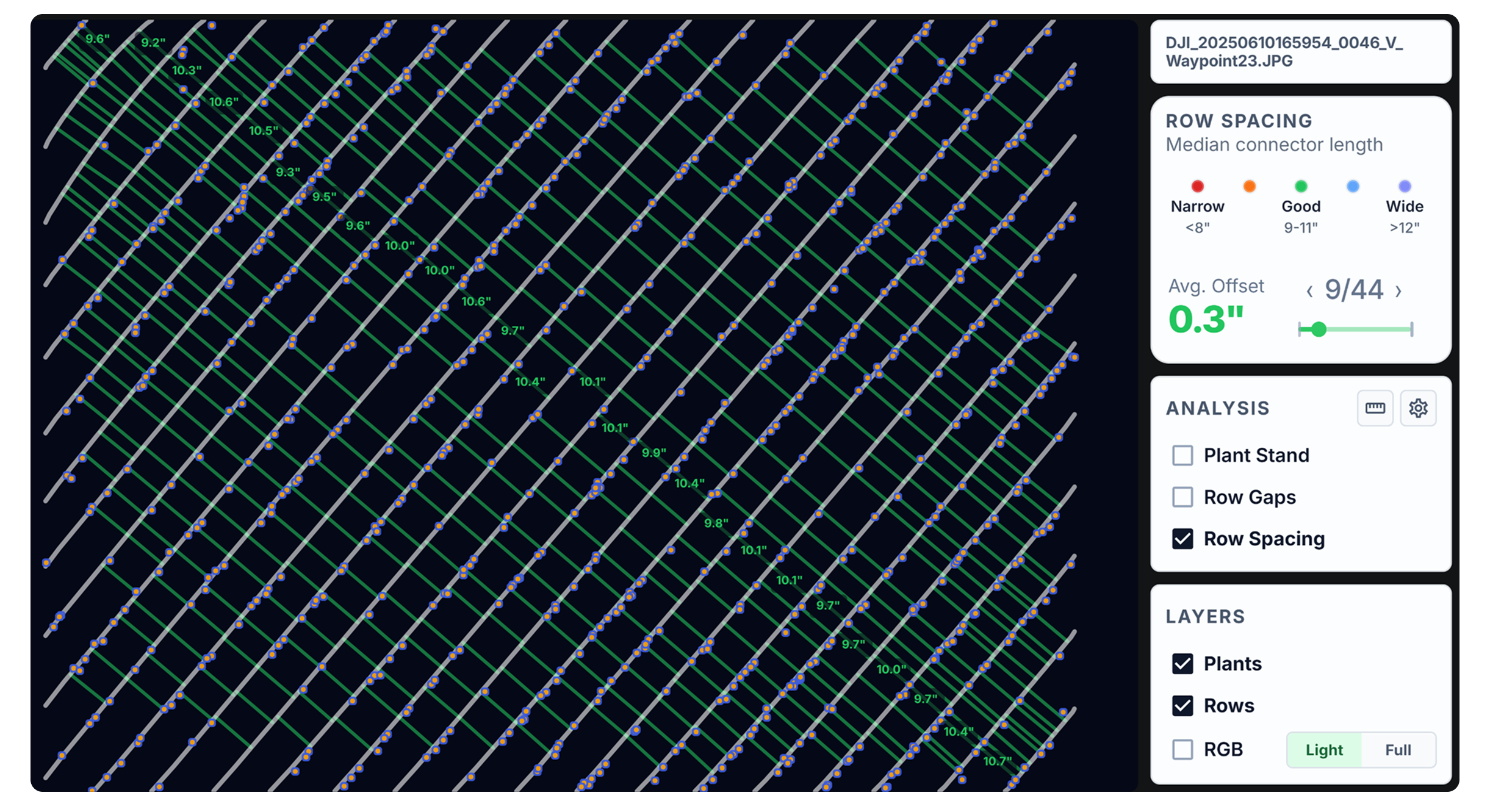
By detecting each row and its distance to neighbor rows in pixels, we can use our known equipment row spacing to get scaled, quantitative metrics like plants/ft², row gaps, and plant spacing uniformity.
This means you can just take a couple of pictures in a few minutes, and head to the next field.
Row-Based Scaling Accuracy
To validate our approach, we flew 19 missions with 40-50 photos each, using a 48MP medium telephoto camera on the Matrice 4E. This drone has a built in LRF (Laser Range Finder) which is a time-of-flight sensor to detect how far away the ground is.
We have two independent methods of determining scale - one laser based (expensive/accurate) and one pixel based (cheap/on all drones). We plotted the difference between these two methods below (0% is perfect alignment). The altitude (blue line) ranged from 7-18m across missions.
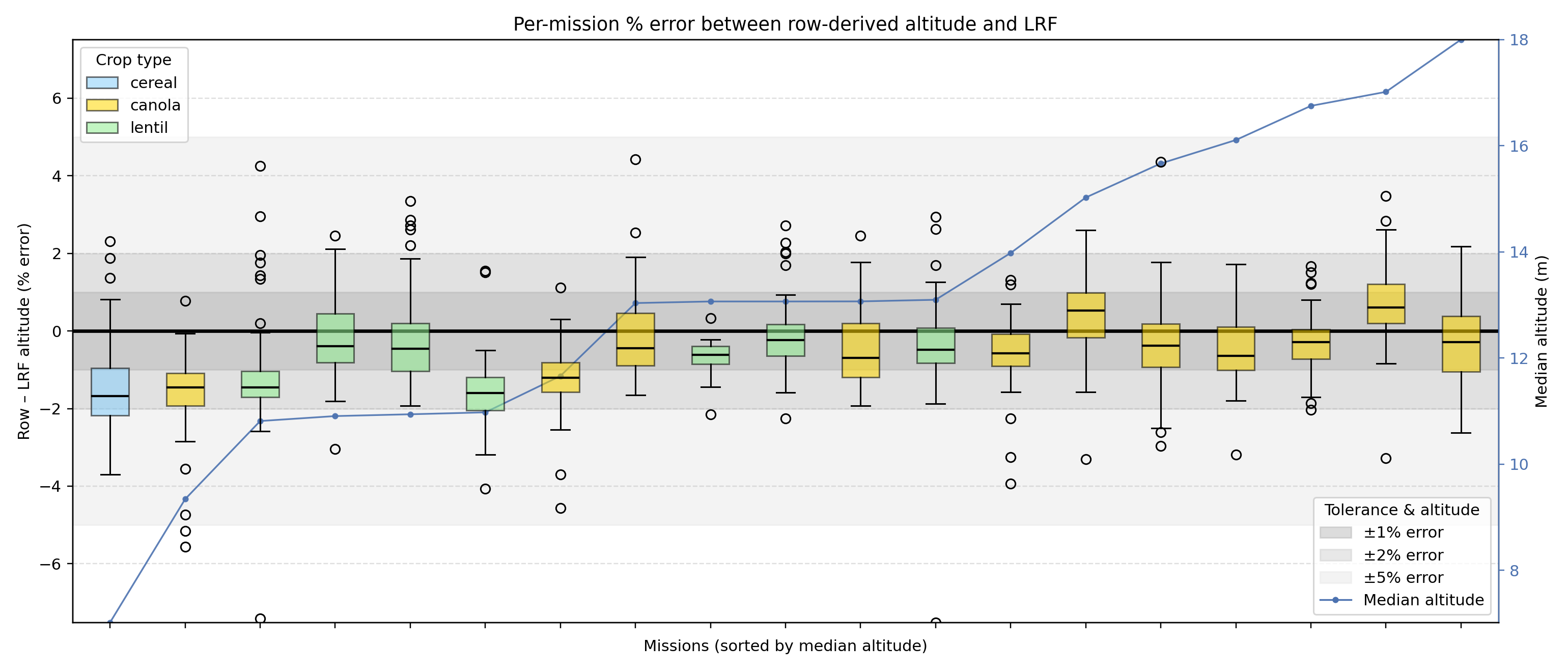
100% of our missions had a median error of less than 2% compared to LRF
74% of the missions had a median error of less than 1% compared to LRF
The half section fields (320ac) took 20-25mins to collect the 40-50 photos
Row based scaling is built into the PlantCounts system and allows users to upload one or many photos to get scaled metrics to help improve your seeding practices.
Article highlights
19
Missions
100%
Median under 2%
74%
Median under 1%
PlantCounts
Reliable stand data without hours of manual counting.
Built for agronomy in Saskatchewan.
© 2026 NovaScout. All rights reserved.